updated Saturday 30 August: Gustav now poses virtually no threat to us.
However, it appears to be growing enormously in strength. At the same time it seems to be heading toward the New Orleans area. The images below appear to be updating as time progresses.
I understand that there has been an increase in the average strength of hurricanes in the last few years, as well as an increase in the number of really dangerous and powerful category 5 storms.
end of update
You can click on the images below to see a larger version of them. Also, most of these images come from Weather Underground's website.

Above is a satellite image of the western Atlantic / Caribbean. There are two storm systems, Hanna and Gustav. They make a nice couple on their tour of the Caribbean. Gustav is the one on the left, closer to us.
Above is an image that shows the expected path of Hurricane Gustav, as of Friday, 29 August.
The above image shows the various paths Gustav is likely to follow according to various computer modeling methods. No method has proven itself to be significantly more accurate to the experts, so the experts use many modeling methods.
Above is an image showing areas that are likely to be affected by tropical storm strength winds, as of Friday, 29 August.
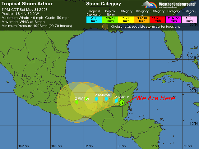
Above is an old image that has a line pointing to where we are. On these sorts of maps it is easy to find where we are. Look at the coast of the Yucatan peninsula, that part of Mexico that curves up and to the East. Find the Northern most Island, below that there is a notch or bay, then further south there is a larger notch. We are right by that second notch, right on the bay. Going past us to the South are a whole series of Islands and Bays along the length of Belize.
Also there is this page.
No comments:
Post a Comment